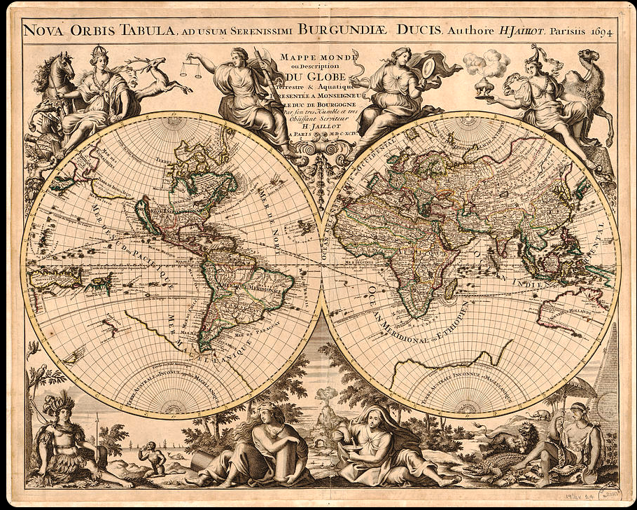
What did your neighborhood look like in 1850? How have national borders shifted over centuries? Which territories existed on maps 200 years ago that have vanished today? OldMapsOnline (oldmapsonline.org) answers these questions by aggregating over 500,000 high-resolution historical maps from prestigious institutions including the British Library, Stanford’s David Rumsey Collection, and the National Library of Scotland into one searchable, interactive platform that makes centuries of cartographic history accessible with just a few clicks.
What Is OldMapsOnline?
OldMapsOnline is the world’s largest search engine for historical maps, functioning as a discovery portal that connects users to digitized map collections from cultural institutions globally. Founded in 2012 through collaboration between cartographers, historians, and technology experts, the platform makes finding historical maps as easy as using Google—search by location, zoom on an interactive map, or browse by time period.
How It Works
- Search by Location: Type a place name or zoom/pan on the world map
- Select Time Period: Use the timeline slider to choose years or centuries
- Browse Results: See available maps for that location and era
- View High-Resolution Scans: Access full-resolution images from source libraries
- Compare Over Time: Use comparison tools to see how places evolved
Key Features
Interactive Map Search
Rather than searching text databases, zoom to any location on Earth and see what historical maps exist for that area. This geographic approach makes discovery intuitive—you’re literally looking at maps on a map.
Timeline Integration
Drag a timeline slider to travel through centuries. Watch as available maps update to show what cartography existed for your chosen location during specific eras. This temporal dimension brings history to life.
TimeMap Feature
The integrated TimeMap shows how political boundaries, territories, and geographic features changed over time. Select any year and see historically accurate borders and place names—invaluable for understanding geopolitical evolution.
Comparison Tools
Side-by-side comparison functionality lets you see how cities, regions, and landscapes transformed across centuries. Watch urban expansion, border shifts, and geographic changes unfold.
Wikipedia Integration
For deeper context, the platform links to relevant Wikipedia articles, providing historical background that enriches map exploration.
Community Contributions
Users can help georef erence historical maps—aligning them with modern coordinates—improving the collection’s accuracy and usability for everyone.
Partner Institutions
OldMapsOnline aggregates collections from world-renowned institutions:
- British Library: Extensive European and colonial maps
- David Rumsey Map Center (Stanford): 150,000+ rare maps
- National Library of Scotland: Detailed Scottish cartography
- ETH Zurich: Scientific and topographic maps
- Library of Congress: American historical maps
- Plus dozens of other libraries, universities, and archives
Strengths
- Massive Collection: 500,000+ maps from trusted sources
- Intuitive Search: Geographic and temporal discovery feels natural
- High-Resolution: Professional-quality scans suitable for research
- Free Core Access: Basic search and viewing completely free
- Educational Value: Invaluable for history, geography, genealogy
- Community-Driven: User contributions improve the platform
- Mobile Apps: iOS and Android apps extend accessibility
- Scholar-Friendly: Proper citations and provenance information
Limitations
- Coverage Gaps: Some regions/periods better represented than others
- Interface Learning Curve: Full features take time to master
- Mobile App Issues: Some users report intrusive ads and stability problems
- Premium Features: Some advanced tools require subscription ($5/month)
- Download Restrictions: High-resolution downloads may be limited or require permission
Use Cases
- Historical Research: Scholars studying geographic and political changes
- Genealogy: Finding ancestral homelands and understanding historical context
- Education: Teachers illustrating historical events and territorial evolution
- Urban Planning: Understanding city development over centuries
- Property Research: Historical land ownership and development
- Personal Curiosity: Exploring how your neighborhood looked historically
Who Should Use OldMapsOnline?
- Historians and Researchers: Professional academic work
- Genealogists: Tracing family origins and migrations
- Geography Enthusiasts: Understanding how places evolved
- Educators: Teaching history with primary sources
- Cartography Fans: Appreciating map-making evolution
- Anyone Curious: Exploring local or ancestral history
Final Verdict
OldMapsOnline represents digital humanities at its best—making vast archival collections accessible to everyone while respecting the scholarship and preservation work of cultural institutions. The ability to explore centuries of cartographic history through an intuitive interface democratizes research that once required visiting multiple libraries across continents.
For anyone fascinated by how places change over time, interested in genealogy, or simply curious about historical geography, OldMapsOnline provides endless exploration opportunities. The platform transforms static archives into dynamic, discoverable knowledge, ensuring that centuries of human geographic understanding remains accessible to future generations.
Whether you’re researching your neighborhood’s development, understanding geopolitical changes, or simply appreciating beautiful old cartography, OldMapsOnline offers a window into how humanity has mapped and understood our world throughout history.
Rating: 5 out of 5 stars
Best for: Historians, genealogists, educators, cartography enthusiasts, geography fans, curious minds
Price: Free (core features) | Premium $5/month
Website: oldmapsonline.org